From Airolo to Thusis (6 days)
First leg
Route: Airolo (1.159m) -
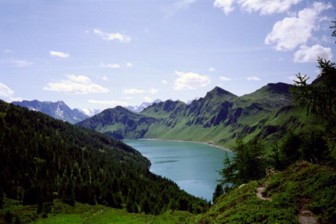
Valle - Madrano (1.156m) - Statione Piora (1.793m) - Lago Ritom (1.850m) -
Capanna Cadagno (1.987m) - Passo Sole (2.376m) - Acquacalda (1.758m). Alternatively,
the route over the Passo Colombe (2.381m) can be chosen instead of the Passo
Sole.
Altitude difference (870 metres ascend, 690 metres descent)
Map: Schweizer Landeskarte 1 : 50 000, Valle Leventina, Blatt 266T
There is a busline from Airolo to Piotta and a cable car to the Lago Ritom, Tessin’s largest dam.
 |
Second leg Route: Acquacalda (1.758m) - Croce Portera
(1.958m) - Dötra (1.748m) - Cantonill (1.738m) - Campo Blenio (1.204m) - Lago
Luzzone (1.590m) - Capanna Michaela (Motterascio) (2.172m) For this lap the so called „Magerwiesen“ near Dörta are worth mentioning. This is beautiful flower-landscape with many rare species. |
Third leg
Route: Capanna Michaela
(2.172m) - Crap la Crusch (2.259m) - Pass Diesrut (2.428m) - Alp Diesrut
(1.899m) - Puzzatsch (1.667m) - Vrin (1.448m) - over Ilanz to Vals using the
bus (1.245m)
Alternative: Crossing the Fuorcula da Patnaul (2.773m) to Vals (one extra day)
Altitude difference: 330 metres ascend, 1.050 metres descent
Map: Schweizer Landeskarte 1 : 50 000, Disentis, Blatt 256; Safiental, Blatt
257
On this leg you cross the Greina-plain, an unique landscape in the alps. Such high-lying plains are normally found in Canada, Alasca or Scandinavia.
Fourth leg
Route: Vals (1.245m) - Zur
Matta - Alpe Wallatsch (1.875m) - Zum Hirt - Valserberg (2.504m) - Wald -
Cassara - Hinterrhein - Nufenen (1.569m) - Splügen (1.457m)
Altitude difference: 1.270 metres ascend, 1.060 metres descent
Alternativen:
a) Descent over the Alpe Plänetsch shortly after Nufenen and further to Splügen
b) from Vals over the Tomülpass (2.450m) to Thalkirch (Safiental) (1.686m), an
ascent of the Tomülerhorns or Piz Tomül (2.945m) can be added to this leg.
|
Fifth leg Sixth leg Route: Safien-Thalkirch
(1.686m) - Camana - Safien-Platz (1.315m) - Glaspass (1.846m) - Tschappina
(1.418m) - Urmein (1.254m) - Thusis (723m) |  |


