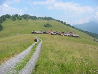
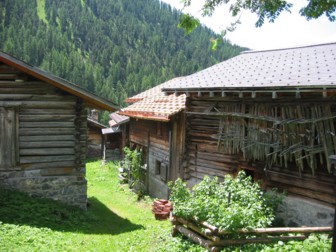
From Thusis to Klosters (4 days)
First leg
Route: Thusis (723m) - Zillis (945m) - Reischen (1.140m) - Samest (1.748m) - Obermutten (1.860m) - Stafel (1.761m)- Mutten (1.395m) - Bi der Müli - Stierva (1.375m) - Sanagn (1.207m) - Tiefencastel (851m)
Altitude difference: 1.030 metres ascend, 1.120 metres descent
Map: Schweizer Landeskarte 1:
50 000, Safiental, Blatt 257; Bergün, Blatt 258
This leg from Thusis to
Zilis goes along the cultural route „Via Mala“ and can be done by bus or on
foot. In Zillis it is recommended to visit the church St.
Martin with its unique Roman painted ceiling from the 12th
century. In Obermutten you will fin Graubünden’s only church fully made of wood.
 |
Route: Tiefencastel (851m)
- Alvaschein (1.004m) - Lenzerheide (1.470m) - Churwalden (1.230m) - Stein -
Büel (1.517m) - Runcalier (1.430m) - Usser-Praden (1.135m) - Tschiertschen
(1.343m) - Ochsenalp (1.936m) - Uf Prätsch (1.985m) - Maran (1.862m) - Arosa
(1.739m) From Tiefencastel to
Churwalden taking the bus is recommended. Covering the distance oon foot would
mean crossing the tourist region of Lenzerheide. |
Third leg
Route: Arosa (1.739m) -
Maienfelder Furgga (2.440m) - Stafel (1.894m) - Davos/Frauenkirch (1.512m)
Altitude difference: 830 metres ascend, 1.050 metres descent
Map: Schweizer Landeskarte 1:
50 000, Prättigau, Blatt 248
Fourth leg
Route: Davos/Frauenkirch
(1.512m) - Davos/Platz (1.558m) - Davos/Dorf (1.560m) - Davos/Wolfgang (1.631m)
- Laret (1.527m) - Klosters/Platz (1.179m) - Kolsters/Dorf (1.124m)
Altitude difference: 120 metres ascend, 510 metres descent
Map: Schweizer Landeskarte 1:
50 000, Prättigau, Blatt 248
Alternative route: a)
| Second leg Route: Tiefencastel (1.377m) - Davos/Dorf (1.560m) - Srelapass (2.355m) - Sapün - Langwies (1.377m) Altitude difference: 800 metres ascend, 1.000 metres descent Map: Schweizer Landeskarte 1: 50 000, Prättigau, Blatt 248 Third leg Route: Langwies (1.377m) - Strassberg (1.919m) - Durannapass (2.117m) - Conterser Schwendi (1.682m) - Serneuser Schwendi (1.622m) - Klosters/Dorf (1.124m) Altitude difference: 900 metres ascend, 1.100 metres descent Map: Schweizer Landeskarte 1: 50 000, Prättigau, Blatt 248 |  |
Alternative route: b)
Second leg
Route: Tiefencastel (1.377m)
- Davos/Frauenkirch (1.512m) - Maienfelder Furgga (2.440m) - Arosa (1.739m) -
Litzirüti (1.452m) - Langwies (1.377m)
Altitude difference: 1.000 metres ascend, 1.100 metres descent
Karte: Schweizer Landeskarte 1: 50 000, Prättigau, Blatt 248
Third leg
see either second or third leg of the alternative a) just the different direction.


